Where would you be on that rough picture? With maps, you can start to see patterns of where people live, roads and buildings, and open land. Even at home, you can map the different rooms: bedroom, kitchen, living room, etc. Everything is somewhere! And, wow, there are reasons why things are where they are. Stores want to be at the corner of the street so they can be seen more easily and visited more often. Trees grow where there's enough soil and water and sunlight. It's not just patterns, but relationships of how one thing affects another.
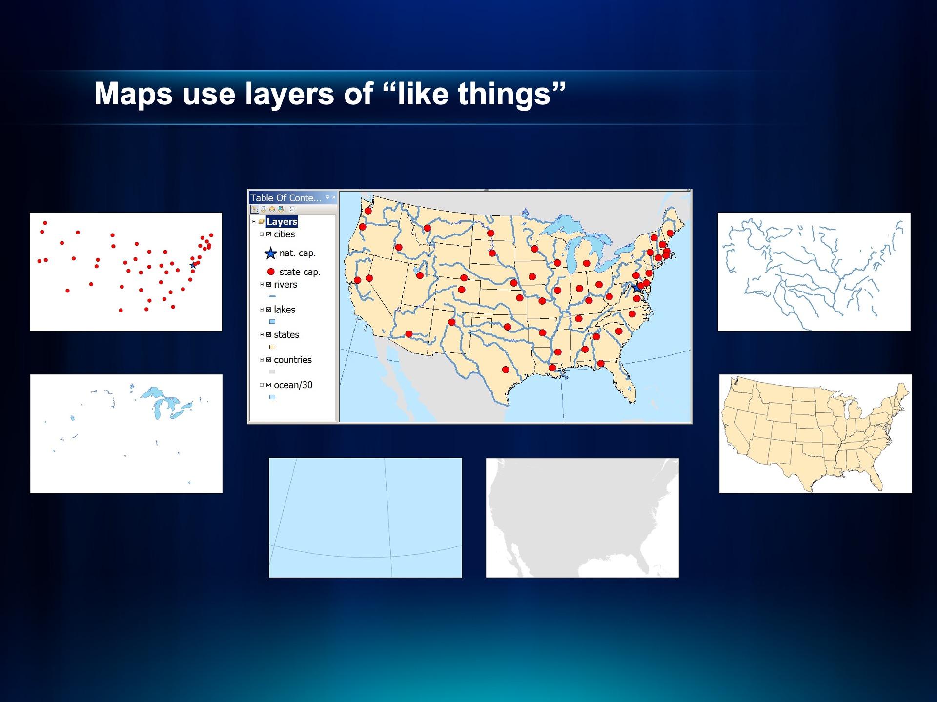
Maps helped me focus, and I began to see the world more clearly. I started seeing "layers" of the world, like a sandwich, with its land, waters, roads, buildings, neighborhoods, people, and so much more. Even just following one street in a straight line for a mile, things changed. Discovering these patterns and relationships was so mindblowing that it inspired me to became a geography teacher. On my classroom wall was a sign that read, "Geography is: (1) What's where? (2) Why is it there? (3) So what?" Maps answered the first question directly, and sometimes pointed to the second question, but question three depended on how we think about the situation. That was the magic of the question, "So what?" It depended on seeing and understading "What's where?" and detecting "Why is it there?"
After teaching for several years, I got my first computer. Then, I learned to make tables of data, like students do in science class, with rows of similar things and columns of descriptions about those things. I wanted to do that about places, but it took time for computer hardware and software to get stronger. Eventually that happened, and I joined Esri.