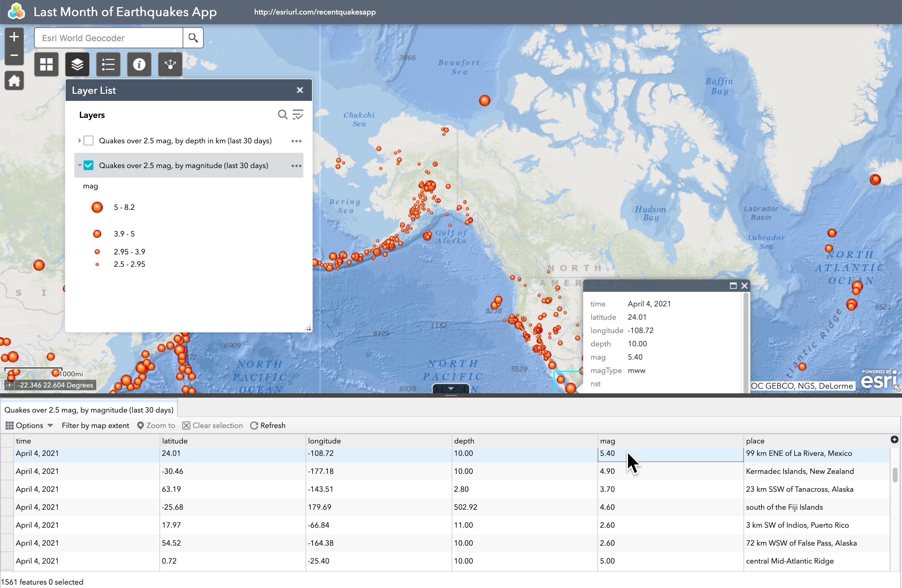
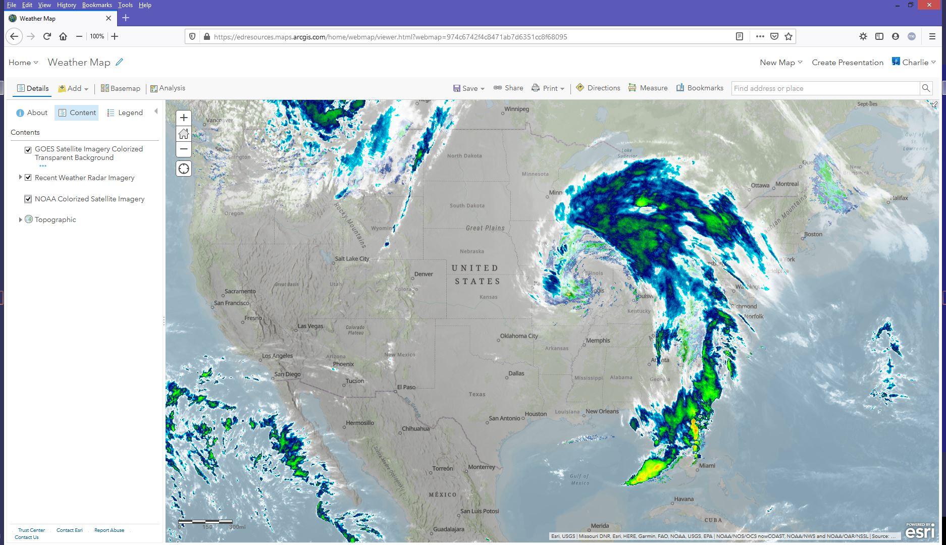
Now my job is to help teachers and students use computers to add layers of data onto a digital map. Then I show how to use the power of computers to explore, ask questions and display the result. It's BEAUTIFUL! The computer lets you zoom in to see details much closer or zoom out to see broader patterns. Zoom in and out, move here and there, turn layers on and off, shift the basemap that your layers cover, make your layers slightly see-through--even do math on those characteristics. Changing how things look shows patterns. You can also ask questions to the computer such as, "Show areas more than a half mile from public bus lines," or "Display stores only if they sell fresh food."
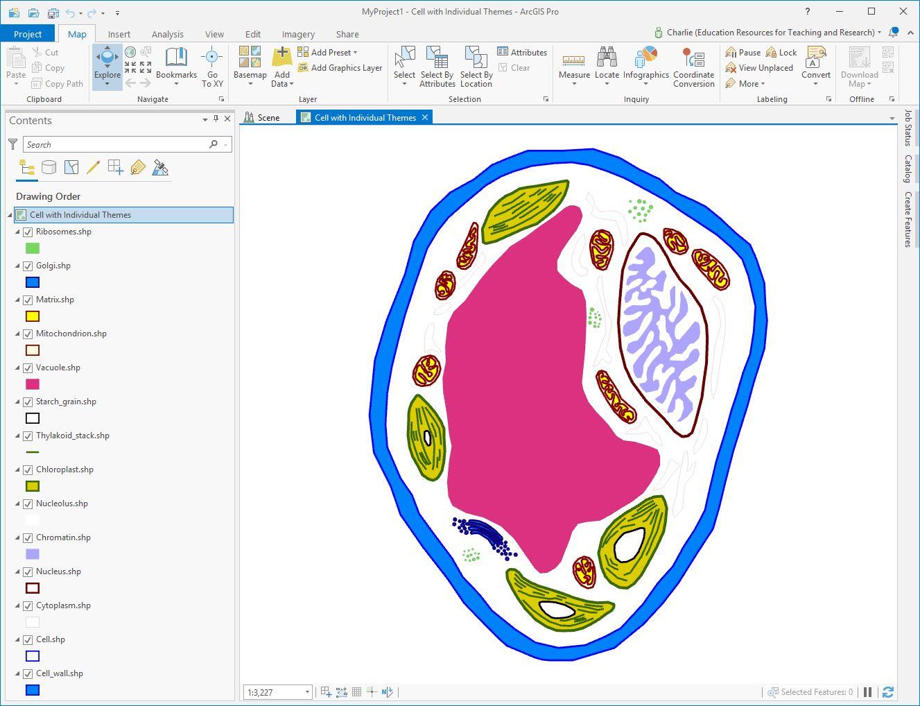
When we know where things are located and discover why they are there, we can decide how best to make changes and improve people's lives. While most people use maps to think about "human-sized spaces," they can also be used to see the size of a single cell, or even contemplate the whole universe. Everyone makes decisions constantly based on where things are. Digital maps and thinking geographically are such a powerful combination!